

» Destination's informations
Back to map �South Dakota
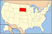
 South Dakota is a state located in the Midwestern region of the United States. It is named after the Lakota and Dakota Sioux American Indian tribes. Once a part of Dakota Territory, South Dakota became a state on November 2, 1889. The state has an area of 77,116 square miles (199,730 km2) and an estimated population of just over 800,000. Pierre is the state capital and Sioux Falls, with a population of nearly 160,000, is South Dakota's largest city.
 Also known as : The Mount Rushmore State, The Sunshine State
Capital : Pierre
Largest city : Sioux Falls
Population : 4 919 479
Abbreviation : SD
Main cities : Sioux Falls, Rapid City, Pierre, Aberdeen, Mitchell

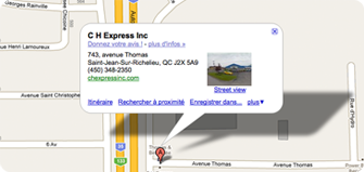
 743, Avenue Thomas